Banga: Difference between revisions
Hari singh (talk | contribs) (→Map: link to map) |
|||
| (4 intermediate revisions by 2 users not shown) | |||
| Line 1: | Line 1: | ||
{{tocright}} | {{tocright}} | ||
'''Banga''' is a town and a Municipal council in | '''Banga''' is a town and a Municipal council in [[Nawanshahr]] (now Shaheed Bhagat Singh district) in the state of [[Punjab]], [[India]]. It is located on the [[Punjab]] Plain to the east of this state. Its population was 10,212 in 1961, and 11,885 in 1971. Now it has a population of about 20,000 and is classified as a Class 2 Municipality. | ||
[[Nawanshahr]] district in the state of [[Punjab]], [[India]]. It is located on the [[Punjab]] Plain to the east of this state. Its population was 10,212 in 1961, and 11,885 in 1971. Now it has a population of about 20,000 and is classified as a Class 2 Municipality. | |||
==Geography == | ==Geography == | ||
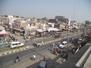
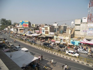
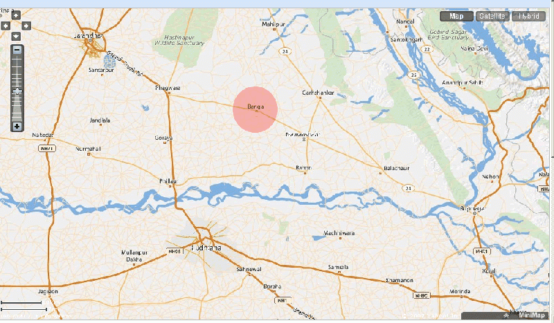
Banga is located at {{coor d|31.19|N|75.99|E|}}. It has an average elevation of 237 metres (778 feet). The town is situated at approximately 325 km from [[New Delhi]], 120 km from [[Amritsar]] and 1400 km from [[Mumbai]]. It is in the North-West part of India; a few hundred kilometres south of [[Kashmir]] and to the west of Himalayan foothills of [[Punjab]] and [[Himachal Pradesh]]. On a clear day, the snow clad peaks of the Dhauladhar range | Banga is located at {{coor d|31.19|N|75.99|E|}}. It has an average elevation of 237 & nbsp;metres (778 feet). The town is situated at approximately 325 km from [[New Delhi]], 120 km from [[Amritsar]] and 1400 km from [[Mumbai]]. It is in the North-West part of India; a few hundred kilometres south of [[Kashmir]] and to the west of the Himalayan foothills of [[Punjab]] and [[Himachal Pradesh]]. On a clear day, the snow clad peaks of the Dhauladhar range are visible on the distant horizon. The Banga Railway station is located on the [[Jalandhar]] City/Jaijon Doaba Line of the Northern Railway at 13 km from Nawanshahar and 44 km from Jalandhar. It is also linked by road with Nawanshahar on one side and with [[Phagwara]] on the [[GT Road]] on the other side. It is located on the main [[Amritsar]]/[[Chandigarh]] and [[Amritsar]]/[[Anandpur Sahib]] route. | ||
[[Image:Main_Road_Banga_I.jpg|left|thumb|300px|A View of Main Road Banga]] | [[Image:Main_Road_Banga_I.jpg|left|thumb|300px|A View of Main Road Banga]] | ||
| Line 11: | Line 10: | ||
== History== | == History== | ||
Banga and the nearby village of Heon was the seat of Parmar rajputs who have there Jathere here. Many who lived in Banga proper and nearby fortress of Heon were converted to Islam, as were other rajputs in surrounding principalities like Gunachaur and Rahon. The remaining Parmars sought refuge in the riverine area of Choes north of Banga across the bein river where they are still found in twelve villages such as Binjon, Panjour, Baddon etc. it was dominated by a community called tah's in the mid 19 century. | Banga and the nearby village of Heon was the seat of Parmar rajputs who have there Jathere here. Many who lived in Banga proper and in the nearby fortress of Heon were converted to Islam, as were other rajputs in surrounding principalities like Gunachaur and Rahon. The remaining Parmars sought refuge in the riverine area of Choes north of Banga across the bein river where they are still found in twelve villages such as Binjon, Panjour, Baddon etc. it was dominated by a community called tah's in the mid 19 century. The town Banga is named after the [[Banga Saini's|Banga Surname]] of the [[Saini]] Rajputs. Currently, it is a Jat dominated town but the town was given to Mann Jats during Akbar's era when the latter became "Darbari Jats". There are numbers of Banga Saini dominated villages still around this town. | ||
==Demographics== | ==Demographics== | ||
Latest revision as of 07:05, 14 February 2024
Banga is a town and a Municipal council in Nawanshahr (now Shaheed Bhagat Singh district) in the state of Punjab, India. It is located on the Punjab Plain to the east of this state. Its population was 10,212 in 1961, and 11,885 in 1971. Now it has a population of about 20,000 and is classified as a Class 2 Municipality.
Geography
Banga is located at . It has an average elevation of 237 & nbsp;metres (778 feet). The town is situated at approximately 325 km from New Delhi, 120 km from Amritsar and 1400 km from Mumbai. It is in the North-West part of India; a few hundred kilometres south of Kashmir and to the west of the Himalayan foothills of Punjab and Himachal Pradesh. On a clear day, the snow clad peaks of the Dhauladhar range are visible on the distant horizon. The Banga Railway station is located on the Jalandhar City/Jaijon Doaba Line of the Northern Railway at 13 km from Nawanshahar and 44 km from Jalandhar. It is also linked by road with Nawanshahar on one side and with Phagwara on the GT Road on the other side. It is located on the main Amritsar/Chandigarh and Amritsar/Anandpur Sahib route.
History
Banga and the nearby village of Heon was the seat of Parmar rajputs who have there Jathere here. Many who lived in Banga proper and in the nearby fortress of Heon were converted to Islam, as were other rajputs in surrounding principalities like Gunachaur and Rahon. The remaining Parmars sought refuge in the riverine area of Choes north of Banga across the bein river where they are still found in twelve villages such as Binjon, Panjour, Baddon etc. it was dominated by a community called tah's in the mid 19 century. The town Banga is named after the Banga Surname of the Saini Rajputs. Currently, it is a Jat dominated town but the town was given to Mann Jats during Akbar's era when the latter became "Darbari Jats". There are numbers of Banga Saini dominated villages still around this town.
Demographics
As of 2001 India census, Banga had a population of 18,892. Males constitute 52% of the population and females 48%. Banga has an average literacy rate of 75%, higher than the national average of 59.5%; with 79% of the males and 73% of females literate. 10% of the population is under the age of six.
External links


